
Guide · Tasmania walks ·
Overland Track: A Planning Guide to Tasmania's Alpine Walk
This publication shares ownership with PeptaraLabs, Lab Ranked Agency, and Dental Link.
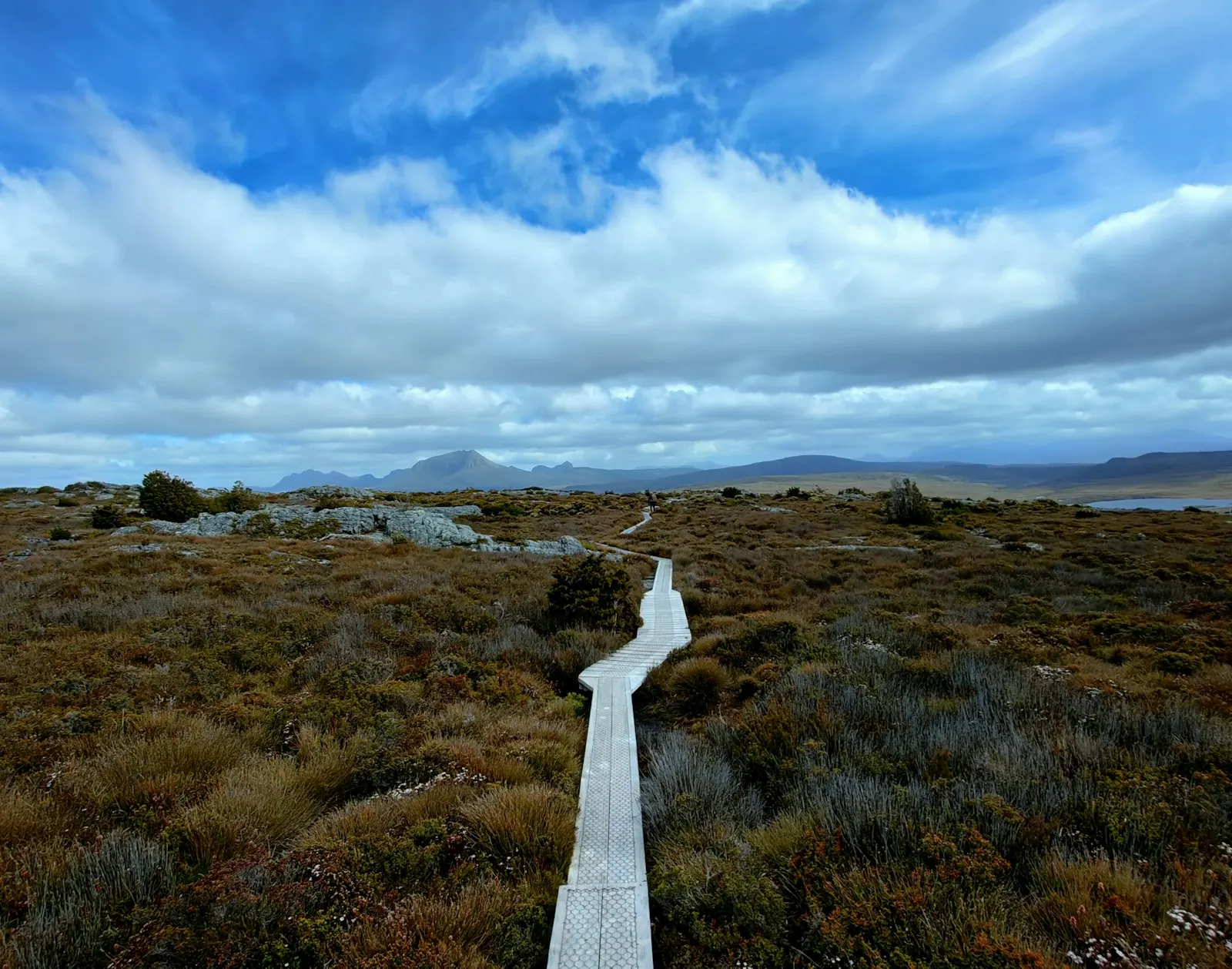
The Overland Track is a 65 km, six day walk through Cradle Mountain-Lake St Clair National Park in Tasmania, part of the Tasmanian Wilderness World Heritage Area. Tasmania's Parks and Wildlife Service (PWS) rates it Grade 4 and calls it a serious walk for fit, well prepared walkers. You must book a departure date and pay a pass fee from 1 October to 31 May, and only 34 independent walkers can start on any one day.
This guide covers the booking seasons and fees, each day of the walk with its distance and hut, the gear PWS asks you to carry, side trips, and how to get to the start and home from the finish.
Sources for this section: Tasmania Parks and Wildlife Service, Overland Track.
Overland Track at a glance
| Fact | Detail |
|---|---|
| Length | 65 km one way, Ronny Creek to Narcissus |
| Time | 6 days one way for most walkers |
| Grade | 4: bushwalking experience recommended, tracks may be long, rough and very steep |
| Height | Almost half the track is above 1,000 m, on exposed plateaus |
| Booking season | 1 October to 31 May, departure date booked and pass fee paid |
| Winter season | 1 June to 23 September, registration needed and a park pass required |
| Daily limit | 34 independent walkers can depart each day |
| Age | Not recommended for children under 8 |
Sources for this section: Tasmania Parks and Wildlife Service, Overland Track.
Booking seasons and fees
PWS runs two seasons. In the summer booking season, from 1 October to 31 May, you book a departure date and pay the Overland Track pass. When we checked the PWS page, the pass cost:
| Walker | Overland Track pass |
|---|---|
| Adult | A$312 |
| Child, 17 and under | A$272 |
| Concession | A$272 |
PWS says the fees are reviewed each year in line with CPI and go to services and upkeep on the track. The pass includes park entry for your walk in the booking season, and it also covers the shuttle bus at Cradle Mountain.
In the winter season, from 1 June to 23 September, there is no pass fee, but you must register and hold a valid park pass. PWS opens winter registrations separately, so check its page for the dates.
The booking system takes independent groups of up to eight people. Larger groups contact the booking team. Concession rates apply to Australian Government Pensioner Concession, Health Care, Seniors and DVA card holders, and you must show the card at check-in.
Sources for this section: Tasmania Parks and Wildlife Service, Overland Track and Overland Track booking information.
The walk, day by day
PWS walk notes set out a six day plan from north to south, plus an optional seventh day along Lake St Clair.
| Day | Route | Distance | PWS time | Main hut sleeps |
|---|---|---|---|---|
| 1 | Ronny Creek to Waterfall Valley | 10.7 km | 4 to 6 hrs | 34 |
| 2 | Waterfall Valley to Lake Windermere | 7.8 km | 2.5 to 3.5 hrs | 34 |
| 3 | Lake Windermere to Pelion | 16.8 km | 5 to 7 hrs | 36 |
| 4 | Pelion to Kia Ora | 8.6 km | 3 to 4 hrs | 34 |
| 5 | Kia Ora to Windy Ridge (Bert Nichols Hut) | 9.6 km | 3.5 to 4.5 hrs | 24 |
| 6 | Windy Ridge to Narcissus | 9 km | 3 to 4 hrs | 18 |
| 7, optional | Narcissus to Cynthia Bay along Lake St Clair | 17.5 km | 5 to 6 hrs | Echo Point Hut on the way |
What each day is like, from the walk notes:
- Day 1 is mostly exposed alpine plateau, with a very steep, short climb to Marions Lookout. PWS suggests delaying your start if the forecast is very severe.
- Day 2 is an easier stretch over heath, lakes and tarns, still above 1,000 m.
- Day 3 is the longest day, across buttongrass plains and through rainforest and eucalypt forest.
- Day 4 climbs to Pelion Gap, between Mount Ossa and Pelion East. PWS says to take breaks in the forest before the gap in bad weather.
- Day 5 passes the historic Du Cane Hut, built in 1910, and side tracks to waterfalls on the Mersey River.
- Day 6 is a gradual, easy walk down the Narcissus Valley to the head of Lake St Clair.
Sources for this section: Tasmania Parks and Wildlife Service, Overland Track walk notes.
Why you must carry a tent
This is the planning point most first timers miss. Huts on the Overland Track cannot be booked, and PWS says there may not be room for everyone, so every walker must carry a tent.
Compare the numbers. Up to 34 independent walkers can depart each day, but Bert Nichols Hut sleeps 24 and Narcissus Hut sleeps 18. On a full departure day, some walkers will be in tents on those nights. PWS says to expect a tent on some nights and shared hut space on others. Tent platforms range from 1 at Pelion (room for 3 tents) to 9 at Kia Ora and Bert Nichols, with overflow camping on grass or forest floor at some sites.
Sources for this section: Tasmania Parks and Wildlife Service, Overland Track and Overland Track walk notes.
Weather and safety
PWS is direct about the risk. The weather can change fast, and severe cold, wet and windy conditions can happen at any time of year, even in summer. PWS says deaths have occurred, including in summer, when walkers were not properly prepared.
What PWS asks of walkers:
- Check the Bureau of Meteorology forecast and any bushwalker weather warnings, and change plans if needed.
- Think about carrying a personal locator beacon. PWS says they can be hired from Service Tasmania shops in Hobart, Launceston, Burnie and Devonport, and in limited numbers from some visitor centres.
- Avoid walking alone, and let someone know your plans.
- Boil or treat water from the hut rainwater tanks before drinking.
- Store food in sealed bags inside your pack, inside your tent. PWS warns that brushtail possums rip tents and packs to get at food.
Sources for this section: Tasmania Parks and Wildlife Service, Overland Track and Overland Track walk notes.
Gear and food
You carry everything for the whole walk, because there is no road or shop until the end. PWS says your gear should fit in a 75 litre pack and weigh about 18 kg, including at least 2 litres of water. Fuel stoves only. PWS recommends buying the Cradle Mountain-Lake St Clair map and notes (1:100,000 TASMAP) before you go, and has a walker pack list on its site.
Sources for this section: Tasmania Parks and Wildlife Service, Overland Track.
Side trips worth a spare day
PWS walk notes list several side trips. Adding a rest day lets you do one without rushing.
| Side trip | Return from the junction | Note from PWS |
|---|---|---|
| Cradle Mountain summit (1,545 m) | 2 km, 2 to 3 hrs | Boulder scrambling; fine weather only |
| Barn Bluff (1,559 m) | 7 km, 3 to 4 hrs | Very steep sections; fine weather only |
| Lake Will | 3 km, 1 hr | Relaxed walk, popular lunch stop |
| Mount Ossa (1,617 m), Tasmania's highest peak | 5.2 km, 4 to 5 hrs | Steep and exposed; not under heavy rain or snow |
| Mount Pelion East (1,433 m) | 2.4 km, 2 hrs | Steep and exposed |
| D'Alton and Fergusson Falls | 1 km, 1 hr | Slippery track, sheer drops at the top |
| Pine Valley Hut | 4.7 km one way | Best as an overnight trip |
Sources for this section: Tasmania Parks and Wildlife Service, Overland Track walk notes.
Getting to the start and home again
- Start: check in at the Cradle Mountain Visitor Centre with your booking confirmation and a completed Overland Track Safety Checklist, do the walker briefing and collect your pass. PWS says passes must be collected by 1.30 pm on departure day, or after 3 pm the day before, and by 12.30 pm in April and May. Then take the shuttle bus to Ronny Creek and sign in at the walker registration booth.
- Finish: most walkers take the privately run ferry from Narcissus across Lake St Clair to the visitor centre at Cynthia Bay. Book it before you start. Or walk the extra 17.5 km along the lake.
- Transport: buses run to Cradle Mountain and Lake St Clair from Hobart, Launceston and Devonport all year. PWS says most walkers plan a spare day either side for travel.
Sources for this section: Tasmania Parks and Wildlife Service, Overland Track and Overland Track walk notes.
A short history
Wikipedia notes that fur trapper Bert Nichols blazed the track in 1931, and that it was officially named the Overland Track by 1937. The area became a national park in 1947, and Tasmania's major national parks were recognised as a World Heritage Area in 1982.
Planning more Tasmania? Our aurora australis Tasmania guide explains how to read southern lights alerts. For a desert long walk, see the Larapinta Trail guide. For family trips, browse the editors' family adventures category, or see all guides.
Guided Overland Track trips are sold by private companies. When comparing them, you may find it useful to read how our editors assess operators. PWS reviews the pass fee each year, so its page has the figure that counts; our desk's email sits on the contact page.
Sources for this section: Wikipedia, Overland Track.
Frequently asked questions
How long is the Overland Track?
The Overland Track is 65 km one way, from Ronny Creek near Cradle Mountain to Narcissus at Lake St Clair. Walking the extra 17.5 km along the lake to Cynthia Bay adds a seventh day.
How much does the Overland Track cost?
The Overland Track pass cost A$312 for adults and A$272 for children and concession holders when we checked. It applies from 1 October to 31 May and is reviewed each year in line with CPI.
When do you need to book the Overland Track?
You need to book the Overland Track for walks from 1 October to 31 May. Only 34 independent walkers can depart each day, so PWS advises booking early. Winter walks from 1 June to 23 September need registration and a park pass instead.
How hard is the Overland Track?
The Overland Track is Grade 4. PWS describes it as a serious walk for fit, well prepared walkers with remote alpine experience, and does not recommend it for children under 8.
Do you need a tent on the Overland Track?
Yes. Huts cannot be booked and may be full, so PWS says every walker must carry a tent.
What is the best time to walk the Overland Track?
The main walking season for the Overland Track is the booking season, 1 October to 31 May, and Intrepid Travel describes November to April as the warmest months. PWS warns that cold, wet and windy weather can still happen at any time, even in summer.
Sources for this section: Tasmania Parks and Wildlife Service, Overland Track and Overland Track walk notes; Intrepid Travel, A novice trekker's guide to the Overland Track.
Sources
- Tasmania Parks and Wildlife Service, Overland Track: parks.tas.gov.au
- Tasmania Parks and Wildlife Service, Overland Track walk notes: parks.tas.gov.au
- Tasmania Parks and Wildlife Service, Overland Track booking information: parks.tas.gov.au
- Wikipedia, Overland Track: en.wikipedia.org
- Intrepid Travel, A novice trekker's guide to the Overland Track: www.intrepidtravel.com