
Guide · Red Centre walks ·
Larapinta Trail: A Walker's Guide to Australia's Red Centre
This publication shares ownership with PeptaraLabs, Lab Ranked Agency, and Dental Link.
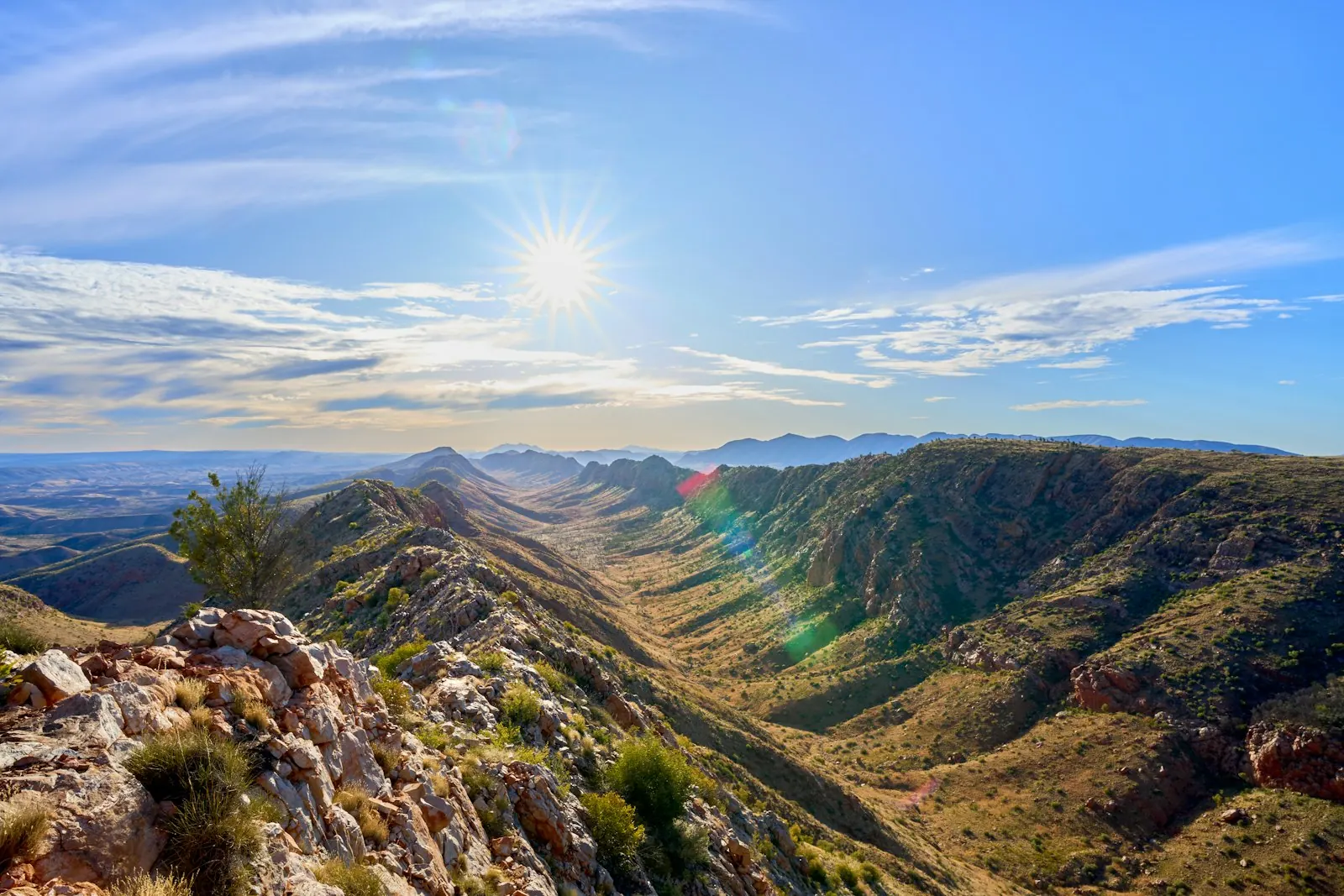
The Larapinta Trail is a long-distance walk of over 230 km along the spine of the West MacDonnell Ranges in Central Australia. It runs from the Alice Springs Telegraph Station west to the summit of Mount Sonder, in Tjoritja / West MacDonnell National Park. NT Parks divides it into 12 sections, each taking one or two days, and most people walk it in the cooler months from May to September.
This guide sets out every section with its distance and grade, the fees, water and food drops, the best time to go, and how to plan a full end-to-end walk or a shorter part of it.
Sources for this section: NT Government, Plan your Larapinta Trail walk; NT Government, Sections of the Larapinta Trail; Wikipedia, Larapinta Trail.
Larapinta Trail at a glance
| Fact | Detail |
|---|---|
| Length | Over 230 km, as NT Parks puts it; Tourism NT lists 231 km |
| Start and finish | Alice Springs Telegraph Station to the summit of Mount Sonder |
| Sections | 12, from 8.9 km to 28.9 km each |
| Campgrounds | 26 designated campgrounds, including a private one at Standley Chasm |
| Fees | Overnight walking fee plus a camping fee for each night |
| Best season | The cooler months, May to September |
Sources quote different lengths: Wikipedia gives 223 km, NT Parks says over 230 km and Tourism NT says 231 km. Adding up NT Parks' own section distances gives 231.1 km, including the 15 km return walk of Section 12.
Sources for this section: NT Government, Plan your Larapinta Trail walk and Sections of the Larapinta Trail; Tourism NT, Larapinta Trail; Wikipedia, Larapinta Trail.
The 12 sections
NT Parks grades each section from 3 (moderate) to 5 (difficult). This table uses its figures, walking east to west.
| Section | From and to | Distance | NT Parks time | Grade |
|---|---|---|---|---|
| 1 | Telegraph Station to Simpsons Gap | 24.7 km | 9 hrs | 4 |
| 2 | Simpsons Gap to Jay Creek | 26.2 km | 8.5 hrs | 4 |
| 3 | Jay Creek to Standley Chasm | 13.6 km | 5.5 hrs | 4 |
| 4 | Standley Chasm to Birthday Waterhole | 17.9 km | 8.5 hrs | 5 |
| 5 | Birthday Waterhole to Hugh Gorge | 14.9 km | 9.5 hrs | 5 |
| 6 | Hugh Gorge to Ellery Creek North | 28.9 km | 10.5 hrs | 4 |
| 7 | Ellery Creek North to Serpentine Gorge | 12.8 km | 5 hrs | 4 |
| 8 | Serpentine Gorge to Serpentine Chalet Dam | 13 km | 5.5 hrs | 4 |
| 9 | Serpentine Chalet Dam to Ormiston Gorge | 28.9 km | 12 hrs | 5 |
| 10 | Ormiston Gorge to Finke River | 8.9 km | 4 hrs | 3 |
| 11 | Finke River to Redbank Gorge | 26.3 km | 9.5 hrs | 4 |
| 12 | Redbank Gorge to Mount Sonder, return | 15 km | 6 hrs | 4 |
A few sections stand out. Section 4 climbs the quartzite ridges of the Chewings Range to Brinkley Bluff. In Section 5 you may need to wade or swim through pools in Hugh Gorge. Section 9 is one of the hardest, with no reliable surface water, so NT Parks says to carry a 2 day supply of drinking water. Section 10 is the shortest and passes the headwaters of the Finke River.
Sources for this section: NT Government, Sections of the Larapinta Trail.
Best time to walk the Larapinta Trail
Walk in the cooler, drier months. Wikipedia notes that summer temperatures on the trail can pass 45°C, so most people walk in winter, when the days are cooler. Walkers' guides point to May to September as the main window, and warn that nights can still drop below freezing.
The same cool-season logic applies at Uluru, 465 km by road from Alice Springs, where the average maximum stays between 20°C and 30°C from May to September. If you are combining both, our best time to visit Uluru guide has the month by month table.
Sources for this section: Wikipedia, Larapinta Trail; Beyond Wild Places, Guide to hiking the Larapinta Trail; Parks Australia, Uluru When to come and Getting here.
How long it takes
The full trail usually takes 12 to 16 days. One walker's guide gives 14 to 15 days as the most popular plan, with some people finishing in 12 and others taking 18 with rest days. Each NT Parks section is a one or two day walk, so you can also do a single section or a few in a row. Most trailheads have vehicle access, some only by high-clearance 4WD, which lets you join or leave the trail part way.
Sources for this section: Beyond Wild Places, Guide to hiking the Larapinta Trail; NT Government, Plan your Larapinta Trail walk.
Fees: what a walk costs in park charges
NT Parks charges two separate fees for an overnight walk, and both must be booked and paid online before you go. You cannot pay at the park.
- Overnight walking fee: A$25 per person per night, for adults and children aged 5 to 17, up to A$125 for one walk over consecutive days. Children under 5 are free. There is no family rate.
- Camping fee: the designated Larapinta campgrounds are category B, which costs A$10 per adult, A$5 per child aged 5 to 17, or A$25 for a family of 2 adults and 4 children, per night.
Here is what one adult pays in park fees for some common plans. These are our sums from the NT Parks rates.
| Nights on the trail | Walking fee | Camping fees (category B) | Total park fees |
|---|---|---|---|
| 1 | A$25 | A$10 | A$35 |
| 3 | A$75 | A$30 | A$105 |
| 5 | A$125 | A$50 | A$175 |
| 14 | A$125 (capped) | A$140 | A$265 |
The cap means the walking fee stops at A$125 once you pass 5 nights, but camping fees keep adding up each night. Standley Chasm is a private campground with its own prices, so a night there changes the camping total. Day walks on a section without an overnight stay do not pay the overnight trail fee.
Sources for this section: NT Government, Multi-day walking trail fees; NT Government, Camping fees; NT Government, Plan your Larapinta Trail walk.
Water on the trail
Water is the main planning job. NT Parks says surface water depends on rare, unpredictable rain, so you should rely on the supplies at trailheads. Rangers keep tanks filled along the route, and the Telegraph Station has a tap on the Alice Springs town supply. Standley Chasm has a tap on a local bore.
- Boil, filter or treat tank water, because its quality cannot be guaranteed.
- Use tank water for drinking and cooking only, not for washing.
- Report leaks or low tanks to rangers at Simpsons Gap or Ormiston Gorge.
- Drink regularly. NT Parks notes that thirst is an early sign of dehydration.
The longest gap between supplies on NT Parks' list is 28.9 km, between Serpentine Chalet Dam and Ormiston Gorge on Section 9.
Sources for this section: NT Government, Larapinta Trail water; NT Government, Sections of the Larapinta Trail.
Food drops
Most end-to-end walkers restock with food drops. NT Parks has storage rooms at Ellery Creek South, Serpentine Gorge and Ormiston Gorge. You get a key from the Tourism Central Australia visitor centre, with a A$50 refundable deposit and a A$10 fee that is not refunded.
Use a secure box with a lid to keep out mice and insects. Label it with your name, the date and your pick-up date. You must collect it within seven days of that pick-up date, and rangers remove unlabelled boxes after 14 days. Commercial companies and Standley Chasm also offer food drops.
Sources for this section: NT Government, Larapinta Trail food drops.
Safety basics
- Camp only in designated sites and book a site for each night. NT Parks allows camping elsewhere only in an emergency, injury or illness.
- Carry a way to call for help. One trail guide says a rescue can take between 2 and 12 hours, and recommends a personal locator beacon.
- Check current conditions on the NT Parks Larapinta Trail page before you set off.
- Plan your water for each day. NT Parks says to weigh up the weather, distance, effort and your fitness, and to carry extra for cooking and emergencies.
Sources for this section: NT Government, Plan your Larapinta Trail walk; Hiking Trails, Larapinta Trail; NT Government, Larapinta Trail and Larapinta Trail water.
Highlights along the way
Tourism NT lists Simpsons Gap and the permanent waterholes at Ellery Creek Big Hole, Ormiston Gorge and Glen Helen among the trail's main sights, along with nearly 600 species of plants. NT Parks adds Brinkley Bluff's views, the old rock outcrops of Section 2, said to be over 2 billion years old, and the summit of Mount Sonder, the trail's highest point.
For somewhere to stay before or after the walk, browse the editors' outback retreats category. Heading north after the Red Centre? Our wet season Darwin guide explains why the Top End runs on a different calendar. For Tasmania's alpine equivalent, see the Overland Track guide.
Some walkers book transfers, food drops or a supported trek through a tour company. Before you pick one, the criteria our editors use to judge operators are listed on the methodology page. NT Parks reviews its fees from time to time, and its booking site shows the current ones. The address for our editors is on the contact page.
Sources for this section: Tourism NT, Larapinta Trail; NT Government, Sections of the Larapinta Trail.
Frequently asked questions
How long is the Larapinta Trail?
The Larapinta Trail is over 230 km long, according to NT Parks. Its 12 sections add up to 231.1 km, including the 15 km return walk up Mount Sonder.
How many days does the Larapinta Trail take?
The full Larapinta Trail usually takes 12 to 16 days. Many walkers plan 14 to 15 days, and you can also walk just one or a few of its 12 sections.
What is the best time to walk the Larapinta Trail?
The best time to walk the Larapinta Trail is the cooler season, May to September. Summer temperatures on the trail can pass 45°C.
How much does it cost to walk the Larapinta Trail?
Park fees for the Larapinta Trail are A$25 per person per night for walking, capped at A$125, plus A$10 per adult per night at category B campgrounds. A 14 night walk comes to A$265 in park fees for one adult.
Do you need to book the Larapinta Trail?
Yes. You must book and pay walking and camping fees online before you go, and book a campsite for each night on the trail. You cannot pay at the park.
Is there water on the Larapinta Trail?
Yes, at ranger-filled tanks and taps at trailheads and campgrounds. Treat the water before drinking, and carry enough for long gaps such as the 28.9 km of Section 9.
Sources for this section: NT Government, Plan your Larapinta Trail walk, Multi-day walking trail fees, Camping fees, Larapinta Trail water and Sections of the Larapinta Trail; Wikipedia, Larapinta Trail.
Sources
- NT Government, Larapinta Trail: nt.gov.au
- NT Government, Plan your Larapinta Trail walk: nt.gov.au
- NT Government, Sections of the Larapinta Trail: nt.gov.au
- NT Government, Larapinta Trail water: nt.gov.au
- NT Government, Larapinta Trail food drops: nt.gov.au
- NT Government, Multi-day walking trail fees: nt.gov.au
- NT Government, Camping fees: nt.gov.au
- Tourism NT, Larapinta Trail: northernterritory.com
- Wikipedia, Larapinta Trail: en.wikipedia.org
- Beyond Wild Places, Guide to hiking the Larapinta Trail: beyondwildplaces.com
- Hiking Trails, Larapinta Trail: hiking-trails.com
- Parks Australia, Uluru-Kata Tjuta National Park, When to come: parksaustralia.gov.au